Cyclone Akvan stalls at sea; IMD now expects Andhra landfall between Nellore and Tuni on Friday
The storm barely moved overnight, and IMD now expects it to cross the Andhra Pradesh coast around noon on 20 November as a very severe cyclone. Odisha has begun moving people out, and Andhra is keeping fishermen ashore.
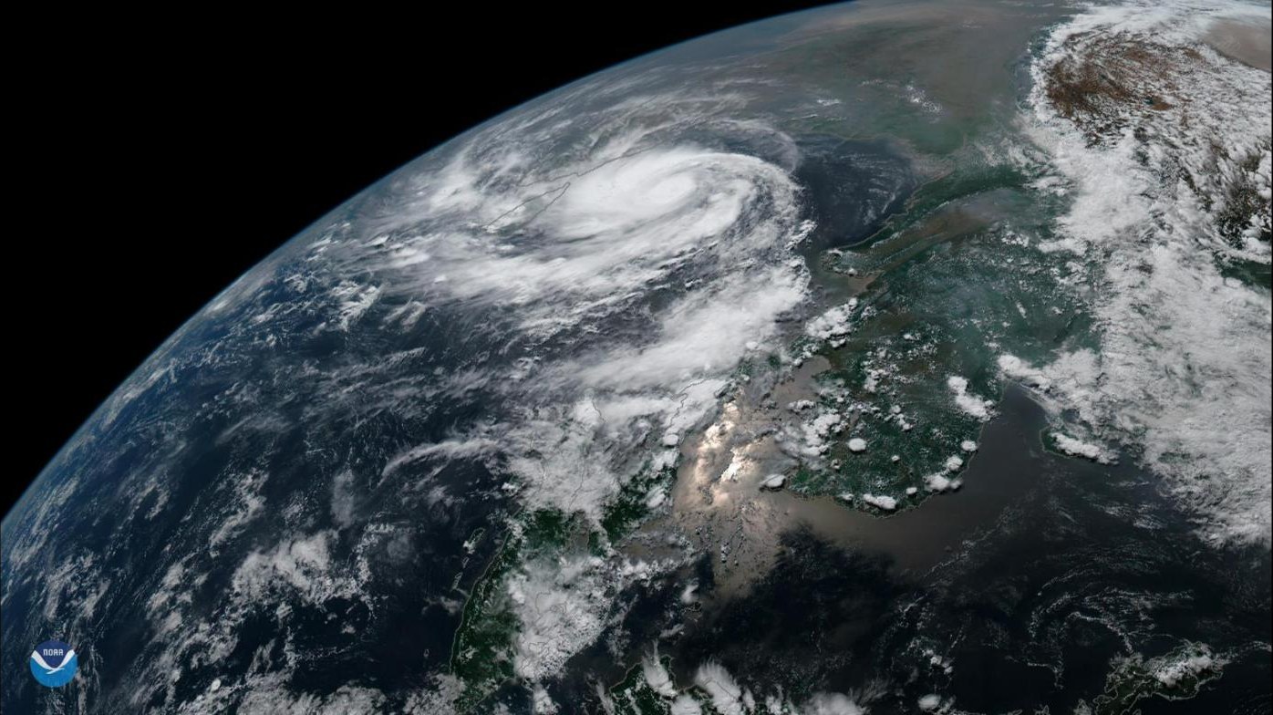

If you live on the Andhra coast, here's the one thing to know this morning: Cyclone Akvan has slowed right down, and that buys a little time but also gives it more time to grow. The India Meteorological Department's (IMD) 5:30 am bulletin on 17 November said the storm had been practically stationary for nine hours over the Bay of Bengal, The Week reported. Its landfall is now expected around noon on Friday, 20 November, between Nellore and Tuni.
That's a shift in timing. NewsKhata's earlier report, based on the forecasts then, pointed to the night of 19 November. Now the IMD expects Akvan to cross the Andhra Pradesh and Yanam coasts a little later, as a very severe cyclonic storm with sustained winds of 120 to 130 kmph and gusts up to 145 kmph, according to The Week and Business Standard.
Where is it right now? On Tuesday morning the storm was about 610 km east of Chennai, 660 km southeast of Machilipatnam, 670 km south-southeast of Visakhapatnam and 790 km south of Gopalpur in Odisha. Prakhar Jain, who heads the Andhra Pradesh State Disaster Management Authority, said it had crawled at just 3 kmph over six hours, IANS reported.
It isn't expected to stay lazy. The IMD forecasts it will become a severe cyclonic storm by Tuesday evening and a very severe one by Thursday morning, before it swings north-northwest towards the coast. A quick bit of jargon: a "very severe" cyclone is the IMD's category for storms with winds of roughly 118 to 165 kmph, strong enough to uproot trees, snap power poles and damage weak houses.
The rain is the bigger worry for many people. The IMD has flagged heavy to very heavy rain at isolated places in north Tamil Nadu and Puducherry on 18 and 19 November, and extremely heavy rain, over 21 cm, at isolated places in north coastal Andhra on 19 and 20 November, The Week reported. South Odisha could see heavy rain until 21 November, and four districts of south Bengal, including South 24 Parganas and Purba Medinipur, have been warned of heavy rain from 19 to 21 November, Business Standard said.
Andhra has had a rough few weeks. Akvan is the third cyclone to head for the state in quick succession, after Arnab and Murasu, which The Week said flattened lakhs of acres of crops and caused losses estimated at nearly ₹7,000 crore. Chief Minister N Chandrababu Naidu held a teleconference with officials on Tuesday morning, told them there was no need to panic, and ordered that fishermen be stopped from going to sea, according to IANS. He also asked that warnings be passed directly to villagers through the state's Swarna Grama and Swarna Ward staff.
Andhra has started moving people to safety as a precaution, The Week reported, though no official evacuation count had been published, and NDRF teams are on standby. At Visakhapatnam Fishing Harbour, trawlers have been called back and marine operations halted, Business Standard said, citing The Hindu.
Odisha isn't taking chances either. It has lined up 74 rescue teams, 60 from its own ODRAF and 14 from the NDRF, and has begun early evacuations in southern districts such as Ganjam, Gajapati, Rayagada, Koraput and Malkangiri, PTI reported. Collectors have been told to move people out of landslide-prone areas and open relief centres.
What's next? The IMD issues fresh bulletins every few hours, and the exact landfall point and timing can still shift. If you're in coastal Andhra or south Odisha, keep an eye on official alerts and follow your district administration's instructions.
Get the day's best stories on WhatsApp. Free, a few a day, no spam.
Follow on WhatsAppSource ledger · स्रोत खाता
Each fact in this story, where it came from, and how it was checked.
| Fact | Source | Check |
|---|---|---|
| IMD 05:30 IST bulletin on 17 Nov: storm practically stationary for nine hours; distances 610 km E of Chennai, 660 km SE of Machilipatnam, 670 km SSE of Visakhapatnam, 790 km S of Gopalpur | The Week | Confirmed, independent outlets |
| IMD 05:30 IST bulletin on 17 Nov: storm practically stationary for nine hours; distances 610 km E of Chennai, 660 km SE of Machilipatnam, 670 km SSE of Visakhapatnam, 790 km S of Gopalpur | Telangana Today (IANS) | Confirmed, independent outlets |
| Moved at 3 kmph over six hours, per AP SDMA MD Prakhar Jain | Telangana Today (IANS) | Single source |
| Landfall between Nellore and Tuni around noon/afternoon of 20 Nov as very severe cyclonic storm; winds 120-130 kmph gusting 145 kmph; severe cyclone by Tue evening, very severe by Thu morning | The Week | Confirmed, independent outlets |
| Landfall between Nellore and Tuni around noon/afternoon of 20 Nov as very severe cyclonic storm; winds 120-130 kmph gusting 145 kmph; severe cyclone by Tue evening, very severe by Thu morning | Telangana Today (IANS) | Confirmed, independent outlets |
| Landfall between Nellore and Tuni around noon/afternoon of 20 Nov as very severe cyclonic storm; winds 120-130 kmph gusting 145 kmph; severe cyclone by Tue evening, very severe by Thu morning | Business Standard | Confirmed, independent outlets |
| Rain forecast: TN/Puducherry heavy to very heavy 18-19 Nov; extremely heavy (>21 cm) north coastal AP 19-20 Nov; Odisha heavy until 21 Nov | The Week | Single source |
| South Bengal districts heavy rain 19-21 Nov | Business Standard | Single source |
| Arnab and Murasu losses nearly ₹7,000 crore, lakhs of acres of crops | The Week | Single source |
| Naidu teleconference: no need to panic, stop fishermen going to sea, warnings via Swarna Grama/Ward staff, clear trees and poles | Telangana Today (IANS) | Single source |
| Evacuations under way in Andhra (no official figure); NDRF on standby | The Week | Single source |
| Visakhapatnam Fishing Harbour: trawlers recalled, marine operations halted (citing The Hindu) | Business Standard | Single source |
| Odisha: 74 teams (60 ODRAF, 14 NDRF), early evacuation in southern districts, relief centres (PTI) | Business Standard (PTI) | Single source |
Corrections to this story: none.